The Trump administration wants to strip lakes, streams, and other waterways around the country from protection by the Clean Water Act. The change would leave some of the nation’s iconic waters vulnerable to pollution.
Among the waters in danger of losing protection:
New Mexico’s Chaco River

The Chaco River watershed, which is just south of the Four Corners where Colorado, Utah, Arizona and New Mexico meet, is mostly on Native American-owned lands. This 100-mile tributary to the San Juan river is already threatened by sand and gravel mining.
Why it’s vulnerable: The Clean Water Act proposal would remove protections from “ephemeral” streams, like the Chaco, that flow in direct response to precipitation.
Nevada’s Las Vegas Wash
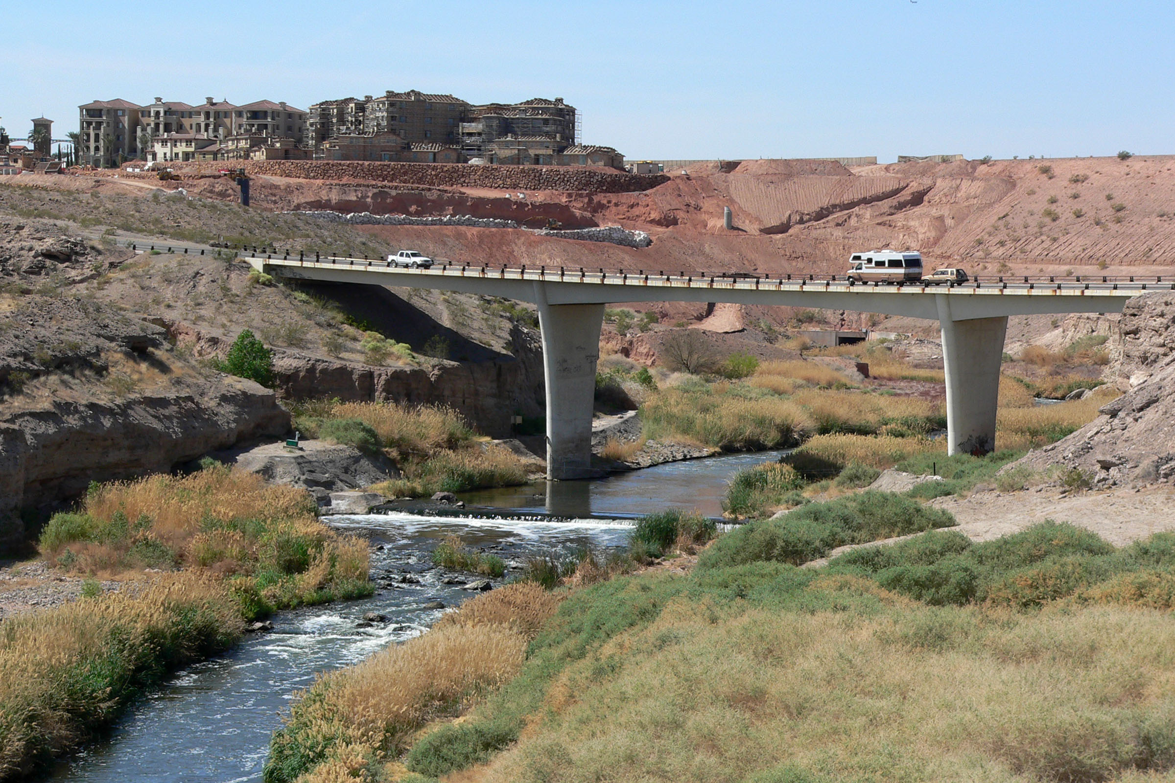
The 12-mile long Las Vegas Wash carries 200 million gallons of urban runoff, shallow groundwater, reclaimed water, and stormwater daily through wetlands, which filter the water on its way to Lake Mead, which supplies drinking water for California.
Why it’s vulnerable: The Wash is considered an “ephemeral” stream.
Oregon’s Crater Lake
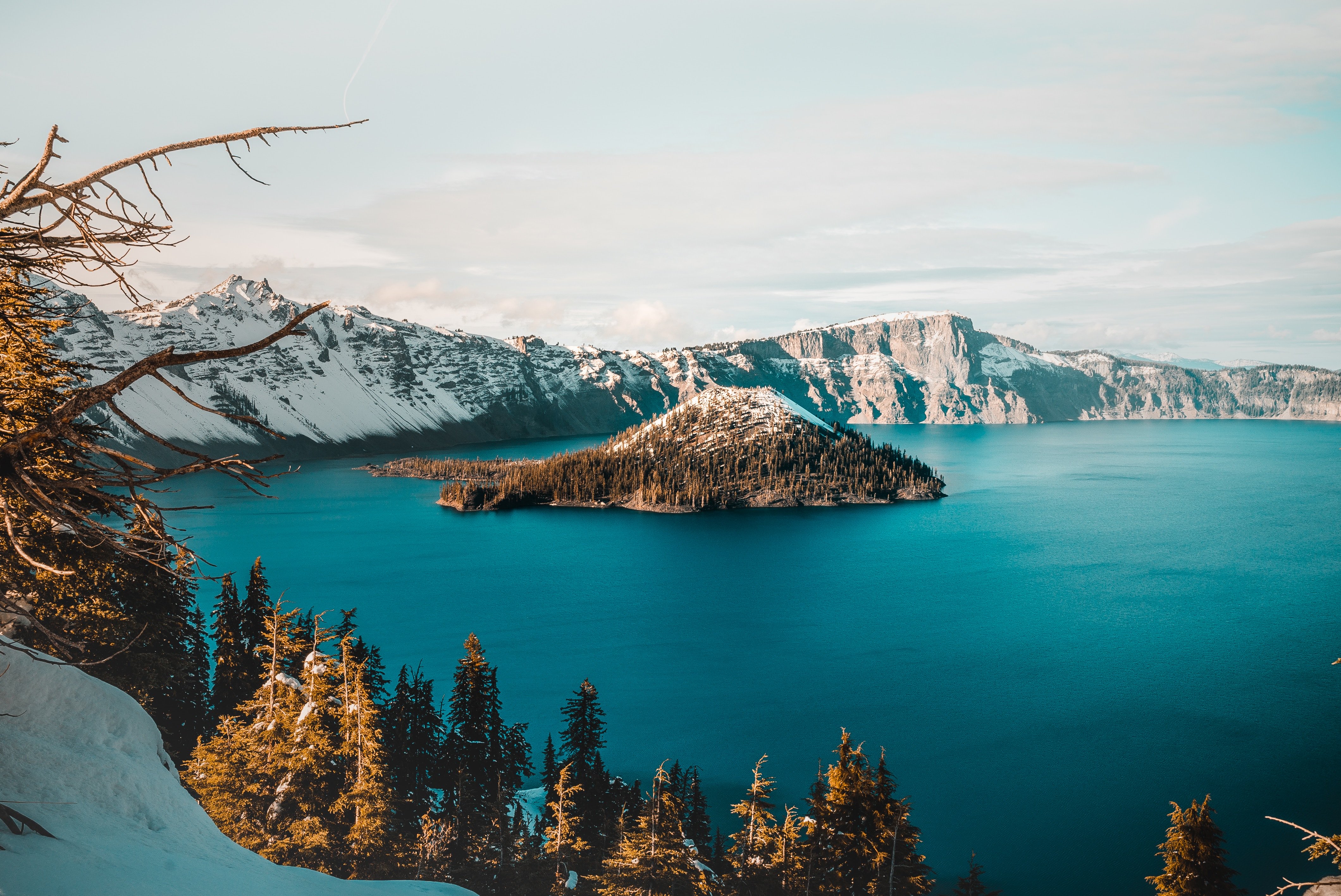
The USGS describes Crater Lake as partly filling “one of the most spectacular calderas of the world, a five-by-six-mile basin formed by collapse of the volcano known as Mount Mazama during a series of explosive eruptions about 7,700 years ago.” With a maximum depth of 1,949 feet, Crater Lake is the deepest lake in the United States — and one of the cleanest in the world. It sits in the heart of Crater Lake National Park.
Why it’s vulnerable: The proposal would remove protections from “isolated” lakes like Crater Lake that don’t connect to waters defined as “traditionally navigable.”
Idaho’s Little Lost River

The Little Lost River is 58.6 miles long, flowing from an elevation of 6,083 feet to 4,000 feet. It’s a favorite spot for trout anglers seeking “great fishing and solitude,” according to the Idaho Department of Fish and Game. The river discharges into the Snake River Plain, going subsurface before reaching the Snake.
Why it’s vulnerable: The proposal would remove protections from tributaries and streams, like the Little Lost River, that don’t connect to “traditionally navigable waters” directly.
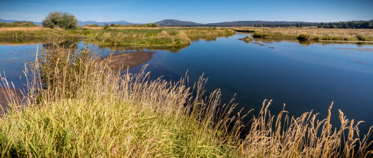
Oregon’s Wood River Wetlands

The 3,200-acre wetland, owned by the Bureau of Land Management, is part of the historic delta of the Wood River and is known for having some of the best trout fishing in the Klamath Basin. The wetlands are isolated from adjoining water bodies by levees and water-control structures.
Why it’s vulnerable: The proposal would remove protections from all wetlands, like Wood River Wetlands, that don’t have surface connections to traditionally navigable waters.