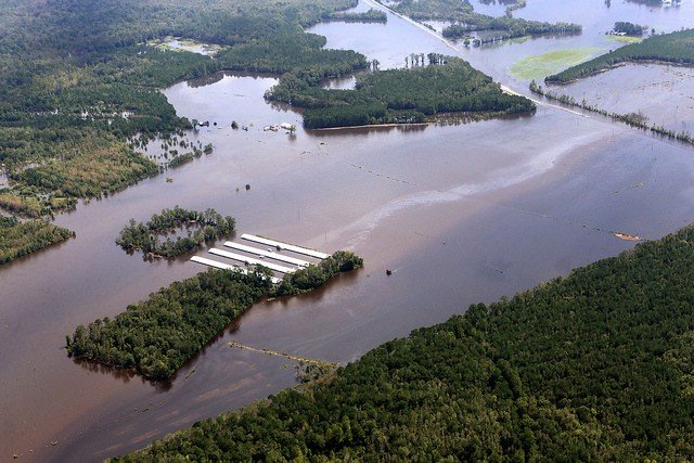
With rivers still rising in the aftermath of Hurricane Florence, Catawba Riverkeeper Sam Perkins created this story map to give the public a sense of environmental hazards that might be vulnerable to flooding.
The map includes locations of river flood gauges, coal-fired power plants, coal ash sites, rivers, the watersheds of local Waterkeeper groups, and concentrated animal feeding operations by type (swine, poultry, cattle, turkey, dairy). We hope the map, which we intend to update with photos and notes from the field, will be a useful resource for the public in the aftermath of the hurricane.
The hurricane has served as a reminder that Waterkeeper Organizations are the voice of their waterways, in good times and bad. More than 200 articles about Hurricane Florence relied on data, background or expert assessment from Waterkeeper Alliance or Waterkeeper Organizations. This map is part of the ongoing work by Waterkeeper Alliance and Waterkeeper groups to be the eyes and ears of the public in the wake of this disastrous storm.