From Lake Coeur d’Alene to the Columbia: A Journey Down the Spokane River
By: Spokane Riverkeeper

By Lee First, Spokane Riverkeeper outreach specialist. Reposted with permission from Adventures NW.
Rivers teach us, and I wanted the Spokane River to teach me.
When I began working for Spokane Riverkeeper, newly arrived in eastern Washington, I knew I had to see the whole river for myself. My Riverkeeper colleagues had long lived along its banks and they do an impressive job of protecting their river, but they hadn’t paddled the river in its entirety. I would be the first among us to do so.
I had begun embarking on month-long canoe expeditions when I was 13 and since then have logged uncountable miles on streams, rivers, sloughs, lakes, and bays. Traveling on “river time” gives me a chance to reflect, to find meaning in minutiae, to see things in new ways, to speculate and to be astonished.
On this trip, I hoped to learn more about who lived along this river and view evidence of huge prehistoric floods. I wanted to be buffeted by winds and pummeled by rapids, to paddle hard and to be overcome by wonder.
The Spokane River is 111 miles long, flowing from its headwaters in the Selkirk Mountains of Idaho to its union with the mighty Columbia at Fort Spokane. The river has been home to native people for more than 11,000 years, its huge runs of Chinook and Coho Salmon once so epic that the Spokane Tribe would trade excess fish for bison meat with tribes of the Great Plains.
Fishing platforms beside Spokane Falls had been an important gathering place for natives from the Coeur d’Alene, Nez Perce, and Palouse country. It is estimated that a half million salmon and steelhead returned each spring.
English explorer David Thompson arrived in 1807 and established a trading post near the Little Spokane River and in a sequence of events repeated throughout the Pacific Northwest, things began to change. In 1882 the Northern Pacific Railroad made Spokane the center of their burgeoning empire and in 1885 electricity was generated by the first of the dams.
Currently there are seven dams on the Spokane and the salmon runs are gone, thanks largely to dams like the Grand Coulee and Chief Joseph Dams on the Columbia, both built without fish ladders. Pollution and industrial agriculture also contribute to the ill-health of the river. Efforts are now underway—spearheaded by the Upper Columbia United Tribes (Coeur d’Alene Tribe of Idaho, Confederated Tribes of the Colville Reservation, Kalispel Tribe, Kootenai Tribe of Idaho and the Spokane Tribe of Indians) —to reintroduce salmon to the river.
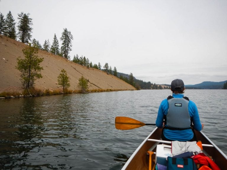
I paddled most of the river in a canoe, using a kayak and raft for short sections only. The biggest challenge overall was the river’s seven dams. The water varies from challenging Class 3-4 rapids (Bowl and Pitcher, Devil’s Toenail) to sluggish weed-infested puddles between the dams.
Coeur d’Alene Lake to Post Falls Dam
The Spokane River’s headwaters are found at Lake Coeur d’Alene in Idaho, a motorboat Mecca. It was here on an early summer day, that my journey begins, with close-up views of jet skis, water ski boats, parasailers, wake boats, and pontoon boats. I am the only non-motorized vessel on the water.
The Coeur d’Alene Basin contains extremely high levels of heavy metals, largely due to pollution coming from Bunker Hill Mine and Smelting Complex (a Superfund Site in Kellogg, Idaho). More silver was mined at Bunker Hill than anywhere on the planet. Beginning in the 1880s (about 90 years before the Clean Water Act) mine tailings containing lead and other metals were dumped directly into the lake’s headwaters. So much lead was emitted from the largely-unregulated smelter that children living nearby had the highest blood lead levels ever recorded in the U.S. Today, lake sediments contain over 75 million tons of lead, cadmium, arsenic, and zinc, with more arriving each year during major floods.

The scenery along this first section of the river is, well, noteworthy. If you go, prepare for astonishingly huge mansions. The 30,000 square-foot “house” built by Amway millionaire Ron Puryear is one such example. Need a place with 13 bedrooms, 13 bathrooms, three docks, a salt water pool, putting green, tennis courts and much, much more? Once, it commanded $20 million. Today it can be yours for a mere $9 million.
There is so much motorboat activity on this section that it is difficult to reflect on the river itself at all.
Post Falls Idaho to Spokane Valley
This next section starts in Idaho, just below Post Falls Dam. Immediately below the dam is the “Trailer Park Wave”—surfing heaven for kayakers in high spring flows. In the summer, this area has much, much less water, which contributes to challenging water-quality conditions (high temperature and low dissolved oxygen) for the river’s special fish, Redband Trout.
Big round boulders are a signature of the middle section of the Spokane River. Between 10,000 and 13,000 years ago, the Cordilleran Ice Sheet blocked the Clark Fork River, which alternatively filled and emptied glacial Lake Missoula. When huge ice dams broke, over 100 floods created Coeur d’Alene Lake and filled the Rathdrum Prairie area with deep layers of sand, gravel, and boulders. The floods forced so much water and boulders downstream that the enormous Spokane-Rathdrum Valley Aquifer was formed, with the river perched above it. To the west, those floods sculpted the entire Columbia Basin and Plateau.
Due to low flows over the Post Falls Dam during much of the late summer, this portion of the river is typically very warm in the summer. These temperatures preclude native trout, which once thrived in these waters, from occupying their native habitat for much of the summer.
Spokane Valley to Downtown Spokane
Between Spokane Valley and Upriver dam are the first views of huge chunks of basalt, and deep holes cherished by trout fishermen. But beware of the beaches and the fish! There is lead in the sediment, and some fish species are also unsafe to eat due to heavy concentrations of polychlorinated biphenyls (PCBs). The PCBs, bioaccumulative toxins, come from a combination of industrial discharges, wastewater treatment plants, storm water, and effluent from consumer items such as soaps, detergents, and dyes.
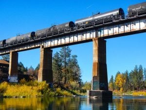
The rapids in this section pack some punches, but as the river approaches the Upriver Dam, the river’s flow calms to a standstill. A dizzying number of coal, oil, grain, chemical, and other products cross the river and head through downtown Spokane every day by rail. Several of these bridges are old and decrepit. The river seems painfully vulnerable. Past Upriver Dam, the water continues to slow until coming to a near stop at Monroe Street, in the heart of downtown Spokane.
Peaceful Valley to Nine Mile Falls Dam
Immediately downstream of Monroe Street Dam is Peaceful Valley. During the spring, when river flow approaches 30,000 cubic feet per second (CFS), this place is busy with rafters and whitewater kayakers seeking thrills in the Bowl and Pitcher and Devil’s Toenail rapids. But by late summer, flows don’t support safe boating in the vicinity of these big waters.
These are the rapids that make this river a destination for many. Powerful drops and waves unleash impressive power. The water is alive with oxygen as it rushes by huge towers of basalt and crashes down into giant holes.
Hangman Creek, a major tributary, joins the Spokane River in this section. With headwaters in Idaho, it flows almost 70 miles through Palouse farmland before this confluence. Most of this stretch has absolutely no riparian vegetation and is farmed right to the water’s edge. Sediment loads and pollution from Hangman Creek degrade fish habitat for a long distance downstream.
Just above Riverside State Park, treated discharge from Spokane’s Wastewater Treatment Plant enters the river. Like many cities along rivers, Spokane dumped trash and sewage directly into the river until forced to change its ways in 1952. In 1970, the Washington State Department of Ecology required the City to upgrade the plant. Today, the City is investing $126 million in treatment technology that will significantly reduce levels of phosphorus, metals, PCBs, and other pollutants from the discharge.
A few miles downstream from Plese Flats is Nine Mile Dam. As in previous sections, the current slows as it fills the pool above the dam.
Nine Mile Dam to Long Lake Dam
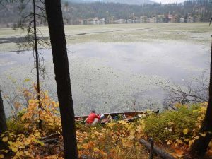
This section is downright depressing. There’s miniscule flow immediately downstream of Nine Mile Dam, and this area is known as Long Lake for a reason. Water quality suffers from low dissolved oxygen and frequent algae blooms, which are terrible for fish and aquatic life. This big puddle is so stagnant it hosts an enormous infestation of the highly invasive noxious weed, fringed water lilies (Nymphoides peltata. It’s not listed as a noxious weed in Spokane County, so nobody does anything about it. Not only is it terrible for water quality and critters that want to live here, it makes for unpleasant paddling.
Another major tributary, the Little Spokane, joins the river just below Nine Mile Dam. Although a pretty little river, it too has problems. In the upper section, cattle trample the banks and defecate in the water. But the downstream section is lovely and worth exploring. Moose, beavers, otters, and all manner of birds and fish thrive here in the cold, clear water dispersed into the mess of weeds in the stagnant waters of Long Lake.
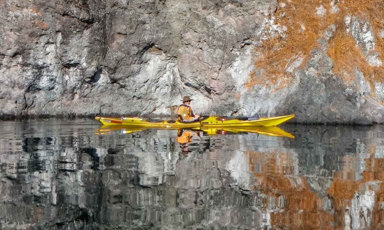
Long Lake Dam to Little Falls Dam

Staring at what must have been a gorgeous, free-flowing section of water, I lose myself in a wistful reverie. I think of Long Lake Dam as a “River Prison.” Below here are steep-sided granite cliffs and a welcome absence of homes or people.
Two stunningly beautiful tributaries enter in this section: Chamokane and Little Chamokane Creek. We discover fresh beaver activity. Looks can be deceiving, though: a closed uranium ore processing plant operated by Dawn Mining Company drains to Chamokane Creek. Although uranium activity concentrations in this creek do not currently exceed the Washington State surface water and drinking water standards, they do exceed the Spokane Tribe’s surface water standard for uranium.
The lowest dam on the Spokane River is Little Falls. I paddle as far up to it as I can, until I reach the ‘No Trespassing’ signs. This dam just breaks my heart. Before the dam was built in 1911, its falls comprised one of the most important salmon fishing areas on the river. Although several dams were already built in the downtown Spokane area at that time, this dam stopped all fish passage to Spokane Falls and deprived Spokane tribal members of their primary food source.
Imagine salmon leaping up falls here. Before this dam, the huge, now-extinct Spokane River Chinook traveled from the Pacific Ocean, up the Columbia, and all the way up Hangman Creek into Idaho.
Little Falls to the Columbia River
This final section, commonly known as the Spokane Arm of Lake Roosevelt, is quiet. There are almost no motor boats or people. All the land on the north side of the river is part of the Spokane Indian Reservation.
The last major tributary, Blue Creek, enters here. Blue Creek drains the Midnite uranium mine, another Superfund site. Warning signs abound. The water and sediments are not safe due to uranium and metal pollution.
I end this long, strange journey at the Columbia River, where there is an enormous boat ramp with a sign reading “The water that backed up behind Grand Coulee Dam in 1942 created an opportunity— for fun. The dam created Franklin D. Roosevelt Lake, 154 miles long with a 660-mile shoreline, ideal for boating, fishing, sailing, and more.” Appalled, I wipe the smudges off my glasses to make sure I’m reading the sign correctly.
If you have a chance, paddle this river and learn the lessons it has to teach. Downstream of Peaceful Valley, the scenery and water are so wild that you’ll forget that you’re floating though Washington’s second biggest city. This trip left me feeling amazed, humbled, and very sad. It was impossible to stop thinking about what the river had been like before the dams and the problems they cause. Seeing the river’s geology, wildlife, dams, fish, and human pressures first-hand intensified my desire to protect this river, and I hope it inspires you to do the same.
*****
Lee First has been a water quality advocate for 30 years. An avid paddler, she’s found her ideal vocation working as a Waterkeeper. She is starting a brand new Waterkeeper organization in Southwest Washington, where you’ll find her protecting and patrolling the waters of Grays Harbor, the Chehalis River, and Willapa Bays.