Aerial Photographs of Flooded Infrastructure in the St. Louis Region
By: Missouri Confluence Waterkeeper
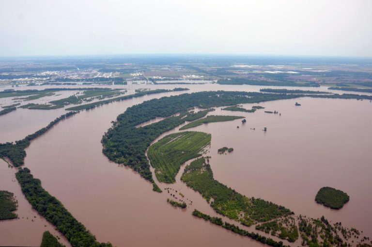
By Missouri Confluence Waterkeeper Rachel Bartels. Republished with permission from Missouri Confluence Waterkeeper
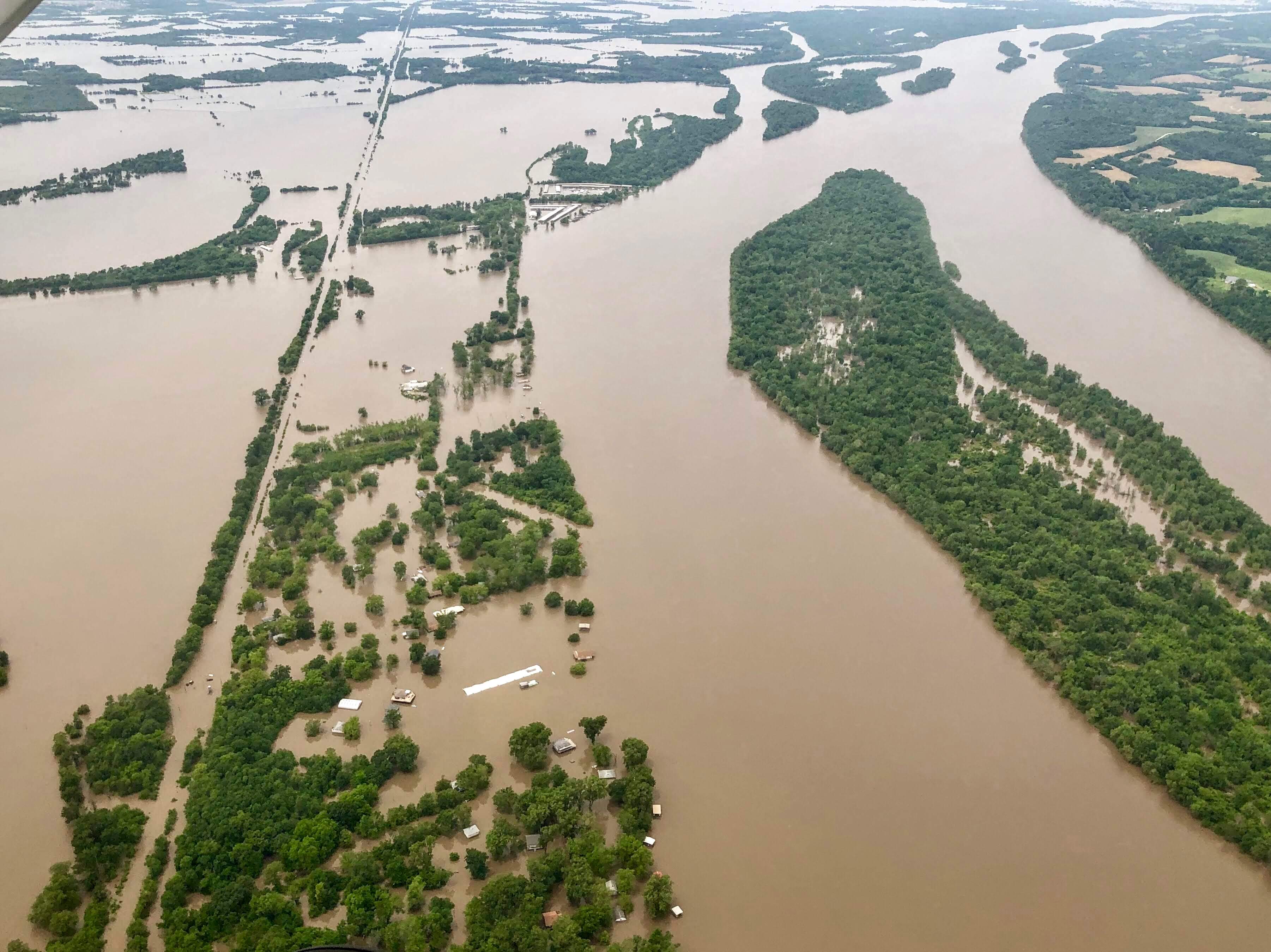
Missouri Confluence Waterkeeper Rachel Bartels and volunteer photographers captured aerial photos of the flooded Missouri and Mississippi Rivers in the St. Louis region during three flights taken between May 28, 2019, and June 3, 2019, where they surveyed the extent of the flooding and assessed how flooded infrastructure will impact the region’s clean water.
Photos posted here for public use.
“The majority of our drinking water is from the Missouri and Mississippi Rivers, so we wanted to get up in the air as quickly as possible to document the hazards and the potential risks to our community,” Bartels said.
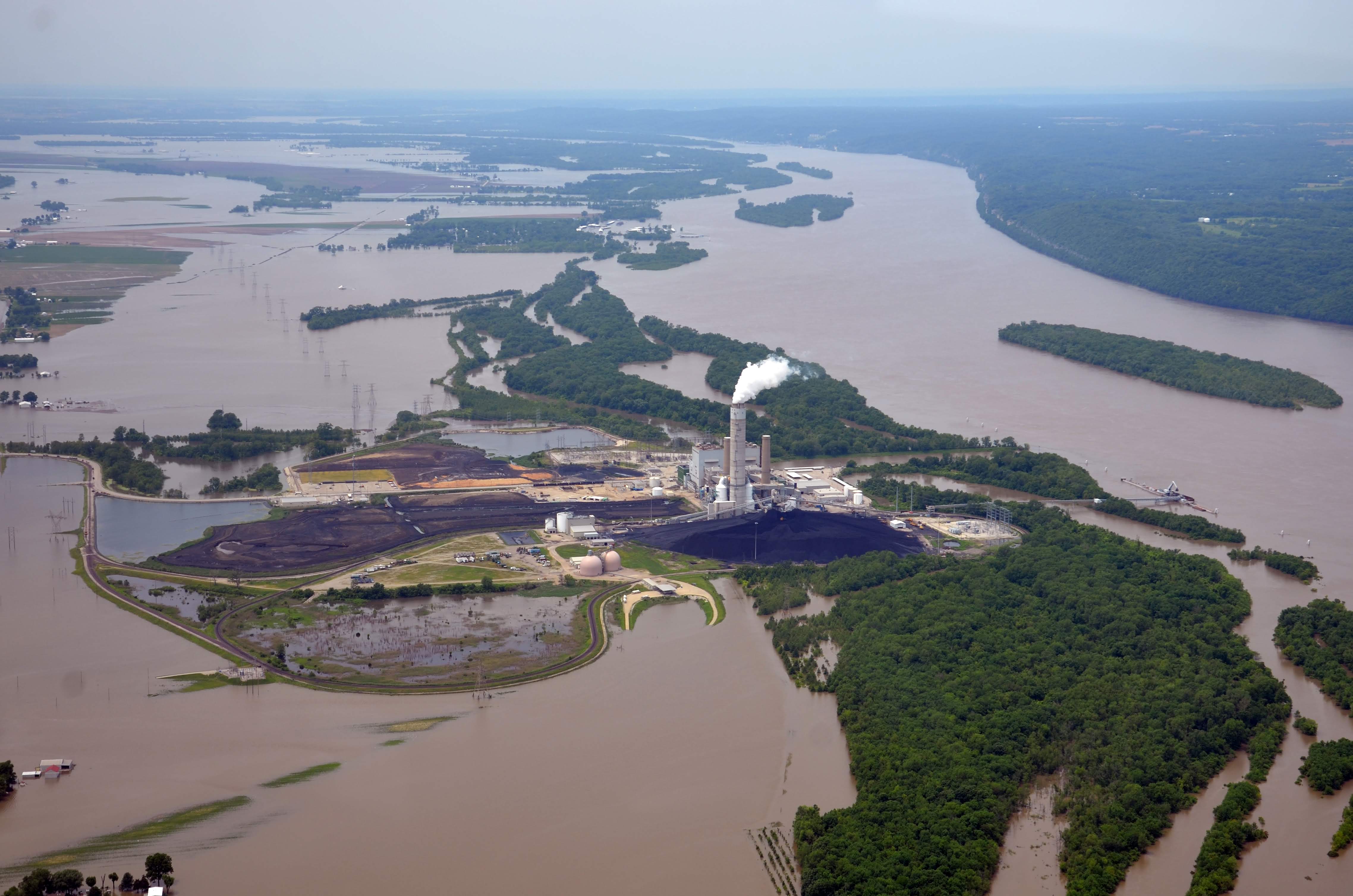

Among the possible hazards are ponds storing highly toxic coal ash along the Missouri and Mississippi Rivers, as well as at the confluence of these two major rivers, which have seen seven major floods since 2008 and experienced three record-setting floods in the past three years alone.
“Coal ash simply shouldn’t be stored in places vulnerable to flooding, near drinking water sources,” Bartels said. “As states like Virginia and North Carolina are reckoning with their own hazardous coal ash storage, opting for completely excavating sites and moving the ash to lined landfills outside of flood zones, it’s vital that we do the same here.”
“Our immediate goal is to inform our community about the long-term effects to human health and the environment posed by the current flooding,” Bartels said. “Our longer-term goal is to raise awareness of the threats to the drinking water we depend on, advocating for solutions that will keep our water safe for generations to come.”
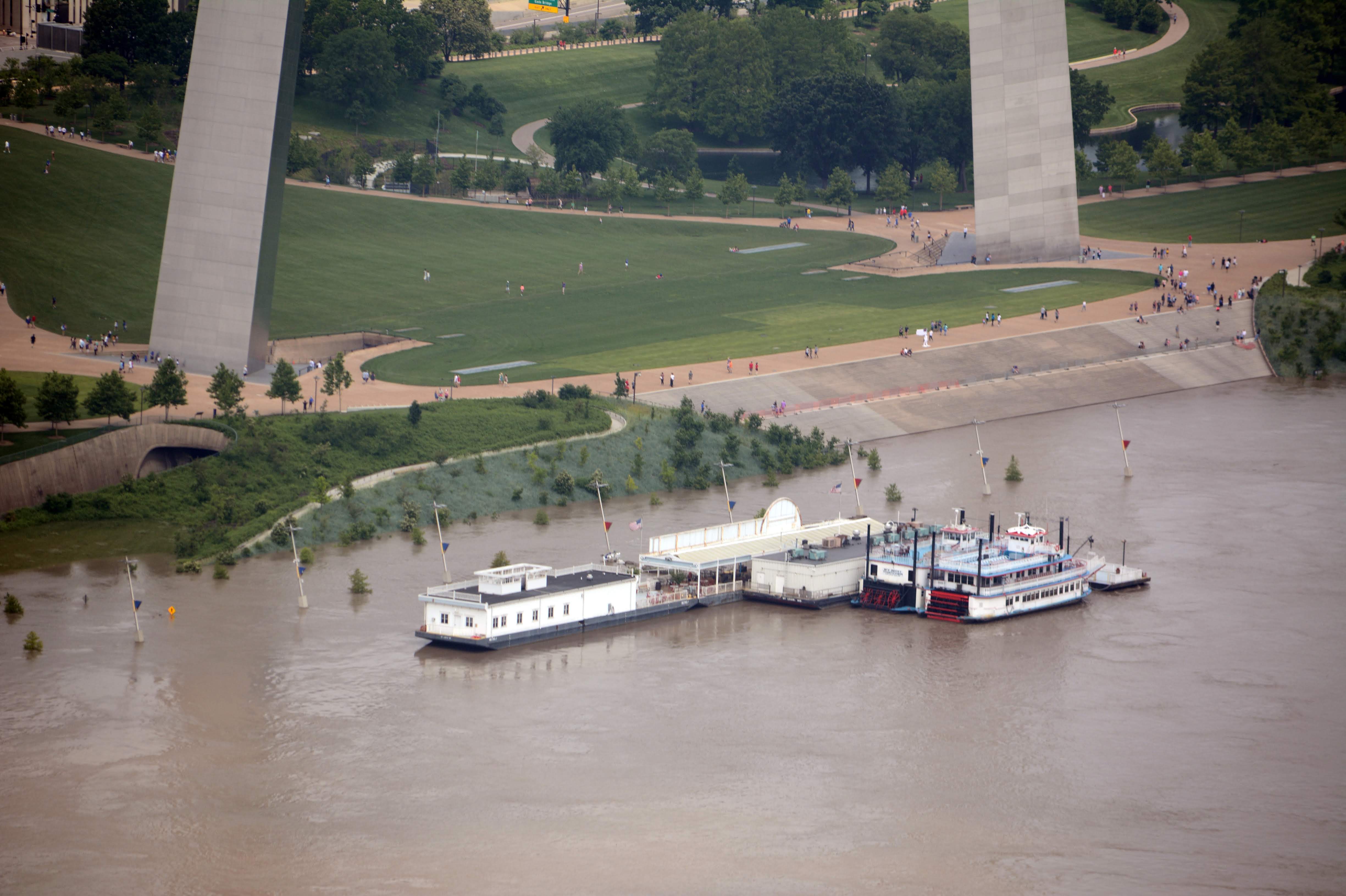
One of the flights was done in coordination with Waterkeeper Alliance and a partnership with LightHawk, which pairs volunteer pilots with conservation organizations. Missouri Confluence Waterkeeper is a licensed member organization of Waterkeeper Alliance. Volunteer LightHawk pilot David Warner flew Bartels and architect/photographer Tom Peterson. Other flights were coordinated privately and for Bartels and photographer Jake Trost and architect Derek Hoeferlin.
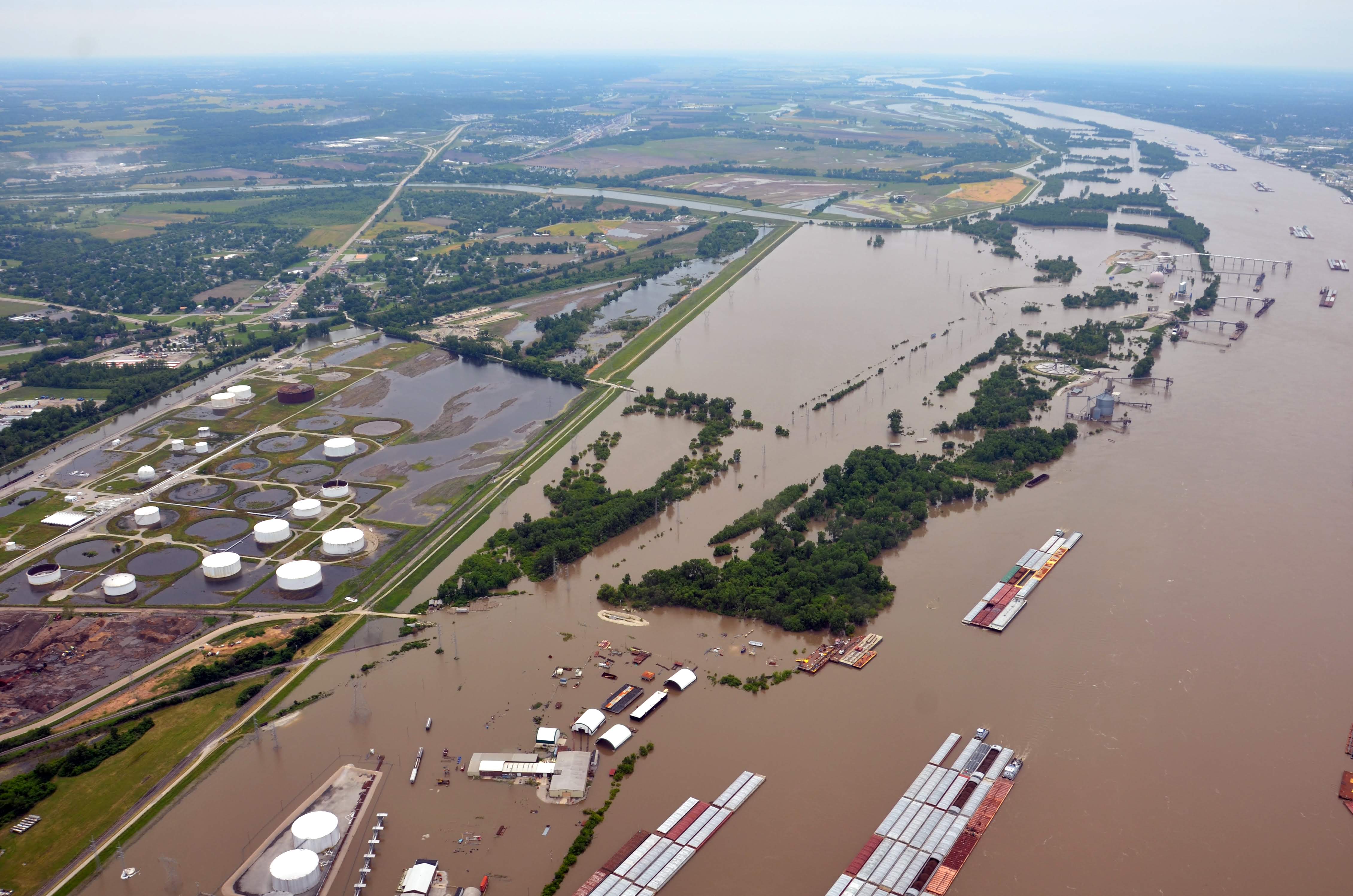
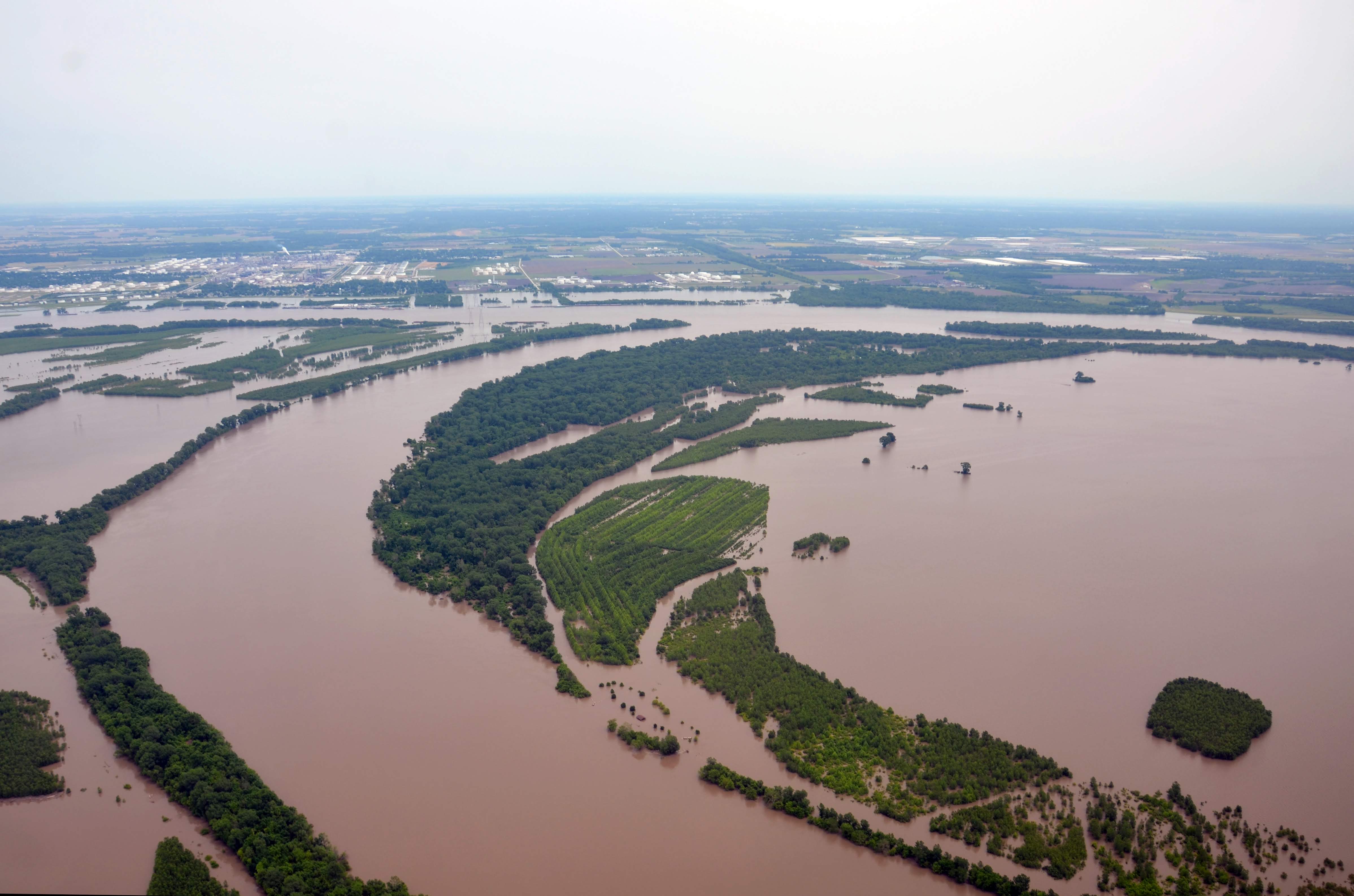
“Although the flooding is devastating, it highlights our collective potential to embrace the middle part of our country as a water-rich, hydro-region for the 21st century,” said Derek Hoeferlin, principal of [dhd] derek hoeferlin design and associate professor at Washington University in St. Louis. “It’s time to rethink how we manage the rivers for everyone’s mutual benefits.”
Missouri Confluence Waterkeeper is preparing to take water samples when the floodwaters recede and will continue to monitor waterways for toxic exposures that can harm human health and the environment.
…..
Missouri Confluence Waterkeeper: Missouri Confluence Waterkeeper is a non-profit 501(c)(3) organization focused solely on clean water and dedicated to protecting the right to fishable, swimmable, drinkable water for all Missourians. To learn more please visit mowaterkeeper.org.
LightHawk: LightHawk is a nonprofit organization dedicated to accelerating conservation success through the powerful perspective of flight. LightHawk mobilizes volunteer pilots, photographers, environmental experts, and storytellers to make images, collect data, inform the public and share their experiences about some of our environment’s most critical issues, landscapes, and wildlife. LightHawk flight campaigns, powered by nearly 300 volunteer pilots and conservation professional staff, foster dialogue and build consensus, promote informed decision-making, and increase conservation project efficiency and effectiveness. Learn more at Lighthawk.org.